LiDAR data collection

LiDAR drones for survey work.

Explore LiDAR systems, payload integration and point-cloud processing for aerial and ground-based collection.

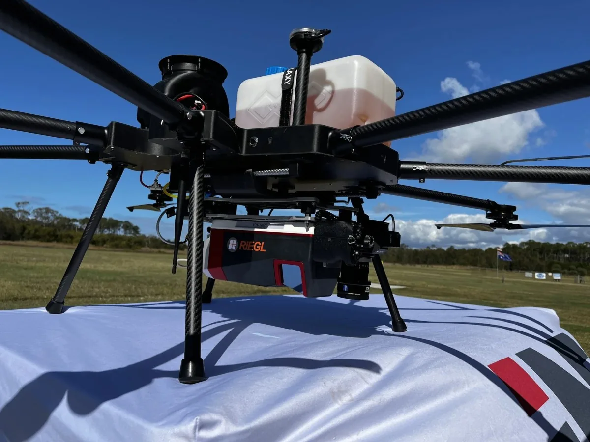
RIEGL VUX-160 LiDAR installed on ScanLift Orbit
RIEGL VUX-160 LiDAR installed on ScanLift Orbit. Original field archive.
Plan the complete setup

LiDAR data collection

A LiDAR configuration involves more than lift capacity. Mounting, clearance, vibration isolation, payload power and positioning all need to work together. Our team can help review the complete setup.

Plan around measured endurance

Patriot achieved 68 minutes in hover with a 1.75 kg payload and 40 Ah battery, to landing voltage. The payload mass is equivalent to a LiDAR USA scanning system; it is not a measured result for a particular powered scanner.

Read the Patriot flight-test summary ↗

Start with these requirements

  • Sensor model and total system weight
  • Required point density and accuracy
  • Flight height, speed and terrain
  • Mounting, power and positioning requirements
Discuss this mission
Start with the deliverable

Plan your LiDAR survey.

These are project-planning considerations. Sensor suitability, integration and achievable results must be confirmed for your mission.

01

Terrain & vegetation surveys

Specify the terrain, vegetation cover and required ground-point density. Sensor selection, scan geometry, positioning and processing determine whether the dataset meets the brief.

02

Corridor & infrastructure mapping

Define corridor length, access points, terrain and required outputs. Plan flight segments and return margins around the actual route; endurance alone does not establish coverage.

03

Earthworks & repeat surveys

Agree on reference surfaces, control points, repeat intervals and quality checks before collection. Use the accepted point cloud or surface model to support the required comparison.

The current range

Patriot endurance. Kestrel X8 configuration.

Designed in Australia. Manufactured in the USA and Australia.

Patriot X4: a measured endurance reference

The manufacturer-reported result is 68 minutes in hover, carrying 1.75 kg with a 40 Ah battery, to landing voltage. That payload mass is equivalent to a LiDAR USA scanning system. It is not a powered-sensor compatibility test.

Explore Patriot for LiDAR ↗

Kestrel X8: configure the shared airframe

Install the Kestrel coaxial arm set to change the shared platform to X8. At 1.75 kg payload, modelled mission time is 42 minutes with 40 Ah or 55 minutes with 52 Ah, excluding a fixed 10-minute reserve. These are estimates, not flight-test results.

Explore Kestrel X8 ↗

Both configurations use tool-free removable arms and landing legs. Include battery, sensor, mount and accessories when checking maximum take-off mass. The mission calculator checks the configured weight and estimates flight time.

Planning questions

LiDAR drone questions.

Will a 1.75 kg LiDAR system match the 68-minute result?

Not automatically. The hover test used an equivalent payload mass; it did not establish endurance with your scanner operating. Include the mount, cables, sensor power, flight profile and conditions when validating a complete system.

What determines point-cloud accuracy?

The complete measurement chain matters: sensor, GNSS/IMU positioning, calibration, flight plan, control and processing. Agree on a validation method and acceptance criteria for your dataset. Aircraft endurance alone does not establish accuracy.

What should I send for a LiDAR aircraft quote?

Send the sensor model, installed payload mass, dimensions, power demand, survey area, terrain, point-density target and desired outputs. The mission brief checklist brings these together.

Let's talk about your mission

Your payload.
Our expertise.

Tell us what you need to carry, where you operate, and what success looks like.

Find your solution